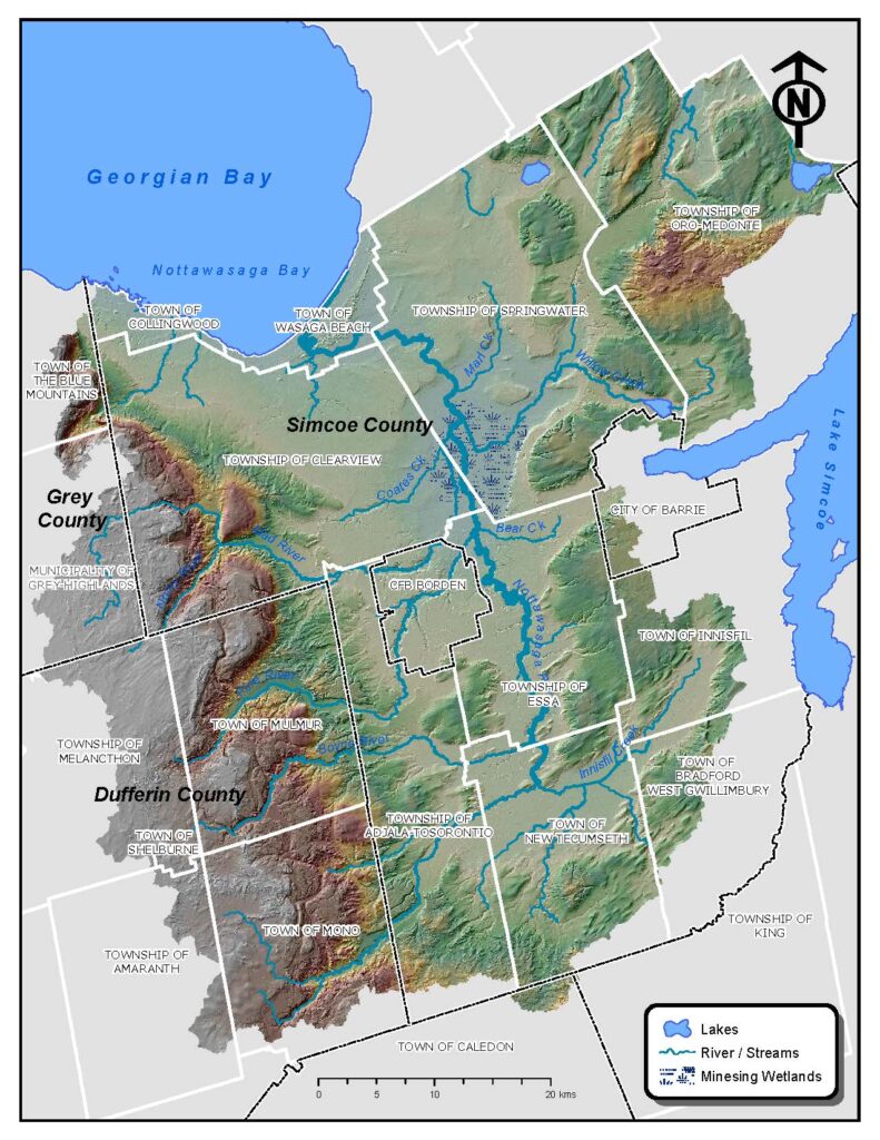
The Nottawasaga jurisdiction is 3,600 km2 and spans from Wasaga Beach in the northeast to Moonstone and Bass Lake, southeast through Barrie and Bond Head to Hwy 9 then eastward to Orangeville then heading north through Collingwood to Nottawasaga Bay. NVCA has a planning role in the northern portions of Springwater and Oro-Medonte Township in the headwaters of river systems that eventually discharge to Severn Sound; however, the Severn Sound Environmental Association completes watershed science activities in this area.
The Nottawasaga Watershed is shaped like a bowl. The rim, or the highest areas of the watershed, are the Niagara Escarpment (a World Biosphere Reserve) to the west, the Oak Ridges Moraine to the south, and the Oro Moraine to the east. At the bottom of the bowl is the Simcoe Lowlands and “chip” of the bowl is Nottawasaga Bay at Wasaga Beach.
The Nottawasaga River is the main river in the 2900 km2 Nottawasaga Watershed. It forms west of the Niagara Escarpment in the Dundalk Till Plains in Amaranth and picks up three major rivers (Boyne River, Pine river, and Innisfil Creek) and countless smaller ones before flowing through the internationally significant Minesing Wetlands. Here, the Mad River and Willow Creek discharge into the Nottawasaga River. As it flows out of the Minesing Wetlands, the Nottawasaga River flows into the Nottawasaga Bay at Wasaga Beach.
The Blue Mountains subwatershed is approximately 222 km2. Here, four rivers form above the Niagara Escarpment, and flow directly into Nottawasaga Bay along the Town of Collingwood shoreline.