Floods can happen when you’re least expecting it. Some areas may not have flooded for decades, but with the right combination of heavy or prolonged rain, snow melt, elevated stream flow, ice/debris jams, soil moisture and other factors, properties and lives are suddenly at risk.
Below are some examples of historic floods in the Nottawasaga Watershed.
Adjala-Tosorontio, Mono, New Tecumseth and Shelburne
On June 23, 2017, Adjala-Tosorontio, Mono, New Tecumseth and Shelburne experienced significant flooding. These areas experienced a storm that had less than a 1% chance of occurring every year.
Crops were badly damaged, causing lost profits for farmers around the area. The emergency spillway at the Tottenham Dam also suffered excessive damage and has since been repaired. A number of roads were closed for a short period of time. Although the water was just 3-6 inches deep, the water took approximately one week to drain from the fields.
NVCA maintains a network of stream gauges and weather stations, which along with real-time weather forecasts and on-the-ground reports are used to issue flood messages. Staff monitor river levels and issue warnings to municipal and emergency management staff when conditions warrant.
As part of the flood contingency, NVCA’s dispatched flood patrol staff into the field to observe the most critical during the flood event. This information was provided to other NVCA staff who were monitoring stream gauges in the office and municipalities and emergency responders.
Angus
The first Angus Plaza was built on an area that used to flood every spring. The plaza was built even with of the trend of flooding and suffered from periodic flooding every year when the river was high in the spring. Any blockage in the Pine River almost guaranteed the Angus Plaza would flood and also many homes along River Drive.
Eventually a berm was built around the plaza to restrict the entry of water. Despite this measure, debris blocked the one way valve and allowed water to once again flood the plaza rather than let the water out as it was designed to do.
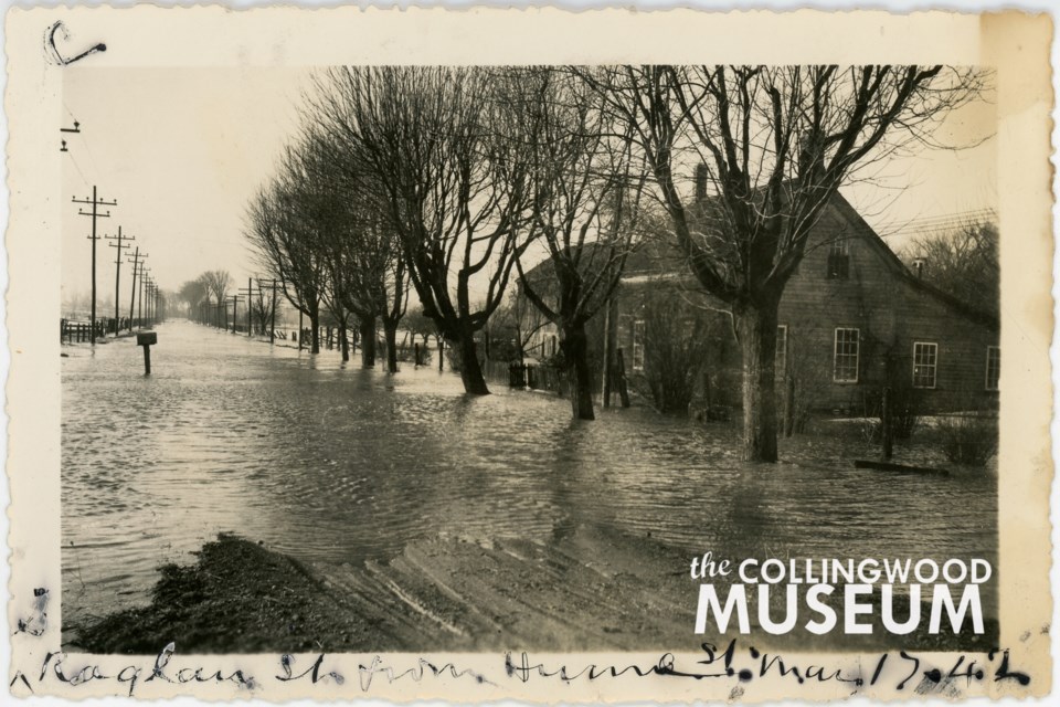
This is a view of Hume Street during the 1942 St. Patrick's Day flood. Photo contributed by the Collingwood Museum Huron Institute 2789; Collingwood Museum Collection X973.523.1, X973.524.1, X973.525.1
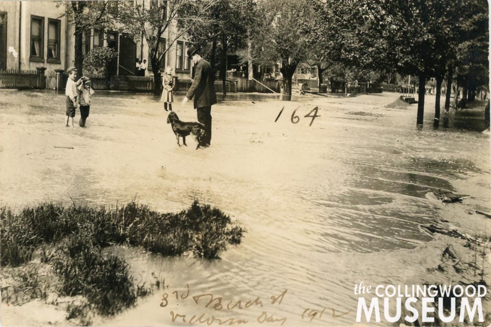
This photo was taken near the intersection of Third and Birch streets during the 1912 Victoria Day flood. Photo contributed by Collingwood Museum Huron Institute 148, 150, 164, 165; Collingwood Museum Collection X970.794.1, X969.594.1, X970.783.1, X970.789.1
A newspaper reported on April 11, 1950 that “Mad River Is High, Creemore Flooded, School Surrounded”. The article detailing the Mad River Flood. “Every cellar in the flooded area had from two to four feet of water in it” resulting in many furnaces being extinguished. Further damage was prevented when the weather turned cold. The village of Dunedin was also flooded when the dam gave way allowing the water to flow down the main street.”
Source: ‘Newsworthy Floods in the Watershed’ by D.Court, Edited by M.Dodd


 Flood Forecasting