Many areas in the Nottawasaga Watershed contain natural hazards. These areas are regulated by NVCA to help avoid the loss of life and damage to property.
The animations below show some of the most common natural hazards found in the Nottawasaga Watershed and where development should be placed in order to be safe.
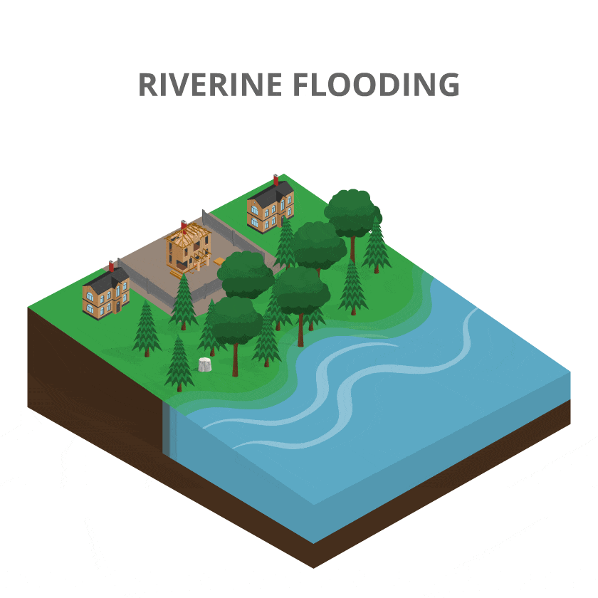
Riverine Flooding
Rainwater and melted snow will flow into streams and rivers causing water levels to rise. During heavy rainstorms and snowmelts, water in these watercourses may flow over its banks into flood plains where flood waters are stored until water levels go down.
NVCA requires new development to be located outside of areas prone to flooding to avoid the loss of life and damage to property. Property owners also need to demonstrate that grading will not impact flood storage capacity around the river.
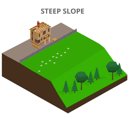
Steep slopes erosion next to rivers and streams
Development on a steep slope that is close to a river or stream can be hazardous due to the high risk of erosion. Steep slopes are areas that are steeper than a 3:1 incline . A 3:1 incline means that for every 1 it is high, it is 3 long.
No Data Found
Shoreline/Georgian Bay flooding and wave uprush
Properties along the Georgian Bay shoreline in NVCA’s jurisdiction are prone to shoreline flooding. When water levels are high in Georgian Bay, properties are covered with more water. Not only can this water flow into buildings and other infrastructure, but waves can cause serious damage as it rushes to the higher shoreline.
NVCA regulates development along the Georgian Bay shoreline to ensure the safety of lives and properties when lake levels are high. The permitting process helps protect investments by ensuring the shoreline repair work doesn’t fail or impact neighbouring shorelines or the environment.
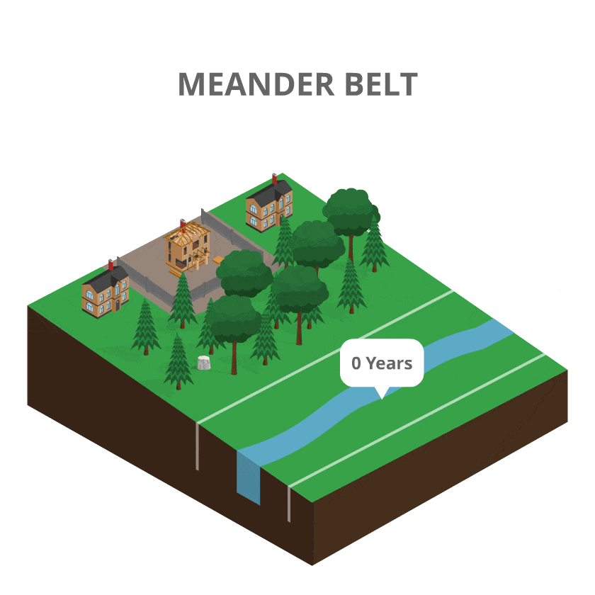
Meander Belt
River and stream banks are constantly moving. This is because water removes sediment from the outer banks and deposits it in the inner banks.
This process is referred to as erosion. The erosion process typically occurs slowly, and many people may not notice the difference until they compare photographs or review aerial imagery!
The area where rivers and streams will move into is called a meander belt. Areas in meander belts experience erosion, including bank erosion and sideways migration, which can lead to the collapse of river banks and damage to developments located nearby. Meander belts also are sensitive ecosystems that provide habitat for many plant and animal species
NVCA regulates development in meander belts to reduce the risks associated with erosion hazards and to protect the natural environment. Regulating development in meander belts also help maintain water quality and protect development from flooding.
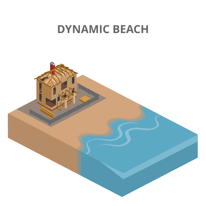
Dynamic Beach Hazard
Flood hazard zones are unpredictable inside dynamic beach areas as elevations change dramatically from season to season and year to year. This is due to the natural processes as sand, rocks and other sediment on the beach builds up. When elevations change, so does the location of the flooding hazard.
The risks of building within dynamic beach areas are even greater when combining the constantly moving sand with changing lake levels.
When lake levels are low, some property owners may think that there is room for development closer to the water. However, when lake levels rise, water may flow into buildings and other infrastructure. Waves can also cause serious damage as it rushes to the higher shoreline.
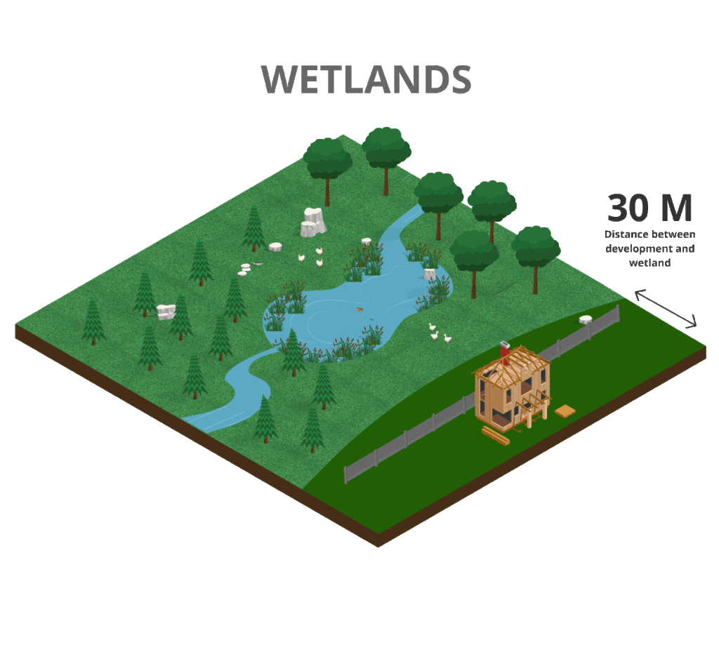
Wetlands
Many plants and animals can only live in wetlands. These include cattails, water lilies, marsh marigold, turtles, frogs, muskrats and many species at risk. Some species can only live in wetlands in the Nottawasaga Watershed!
When developing on or near a wetland, there is an increased risk of changing the way water is distributed across the landscape. All developments must ensure that the water levels in the wetland stay the same as pre-development and does not disrupt the sensitive ecosystem. When water levels in wetlands are too low, the wetland will dry up, removing habitat. Too high, wetland plants will drown, and habitat will also be removed.
It is also hazardous to develop too close to a wetland as soils act like a sponge, and will shift or sink, posing risks to the development.
Some wetlands contain a large amount of groundwater. Disturbing these wetlands can create uncontrollable water flow which can impose significant flood risks to the new development.
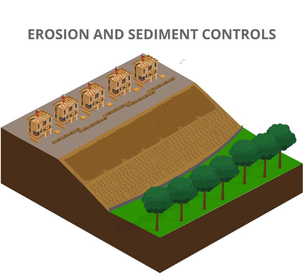
Erosion and Sediment Controls
During development, soils are often exposed and loose. When it rains, water can wash away the soil, clogging up rivers and streams, harming aquatic life, and reducing water quality.
NVCA require property owners to install proper erosion and sediment control measures during construction to prevent sediment from entering rivers, streams and wetlands. These measures include erosion control blankets, silt fences, and filter socks to name a few.
By stopping sediment from entering rivers and streams, you can help keep your property beautiful and help maintain healthy habitats, even after construction.
Regulated Areas
Property owners can see if their property is regulated by NVCA through our Interactive Data Viewer. This map includes information about watercourses, slope hazards, meanderbelts, wetlands, floodlines.
Native/non-invasive vegetation
After construction, it’s time to clean up the site. NVCA requires property owners to submit a site restoration plan along with permit applications.
Plants are the foundation of ecosystems around your property and beyond. NVCA recommends selecting native plants for your site restoration. Plantings should also be compatible and complementary to the existing vegetation communities.
It is important for homeowners to plant native/non-invasive vegetation to support local ecosystems and the spread of prevent invasive species.
Download the Grow me Instead guide to find out what native plants may be suitable for your property.
More information
Starting on April 1, 2024, NVCA will follow a new regulation under the Conservation Authorities Act to review permit applications.
Under the new regulation, the regulated area around wetlands will be 30 m, including provincially significant wetlands. This change will be reflected in NVCA’s regulated mapping shortly. In the interim, NVCA will follow the text in the regulation.
If any part of your property is regulated, submit an online property inquiry form to tell us a bit about your plans. We will review your property and your proposed plan, and may also ask you to submit additional information. We may also request an appointment with you to discuss your plans, by phone or in-person.
 Flood Forecasting