NVCA removed vegetation on the dike in 2006 and 2007. However, a recent study found that vegetation such as trees and large shrubs has continued to grow on the dike, slowing down the flow of flood waters and reducing the capacity of the corridor which in turn could lead to flood waters spilling over the dike during the Regulatory flood event.
River Trail
The recreational trail will continue to be available to residents and visitors. Most of the vegetation beside the trail will remain with the exception of trees that could impact the stability of the dike. After the vegetation removal, trail users will have a clearer view of the river.
Portions of the trail will be closed from time to time for maintenance activities for trail users’ safety.
How will the vegetation be removed?
The vegetation will be removed in two phases for every section.
Phase One – Remove the Understory (small material)
This phase includes removing small woody material such as smaller trees and large shrubs along the slope of the dike. Lower shrubs such as dogwoods and willows along the edge of the water will not be removed. To prevent the spread of invasive species, the vegetation will be disposed at an approved site such as a county landfill or a composting facility.
Phase Two – Assessing and Removing Select Trees.
Once Phase One is completed, NVCA will inventory and assess the larger trees and shrubs and develop a plan to remove those that are compromising the flood capacity of the Pretty River Dike. More information about Phase Two will be available after Phase One is complete.
Maintenance Timelines
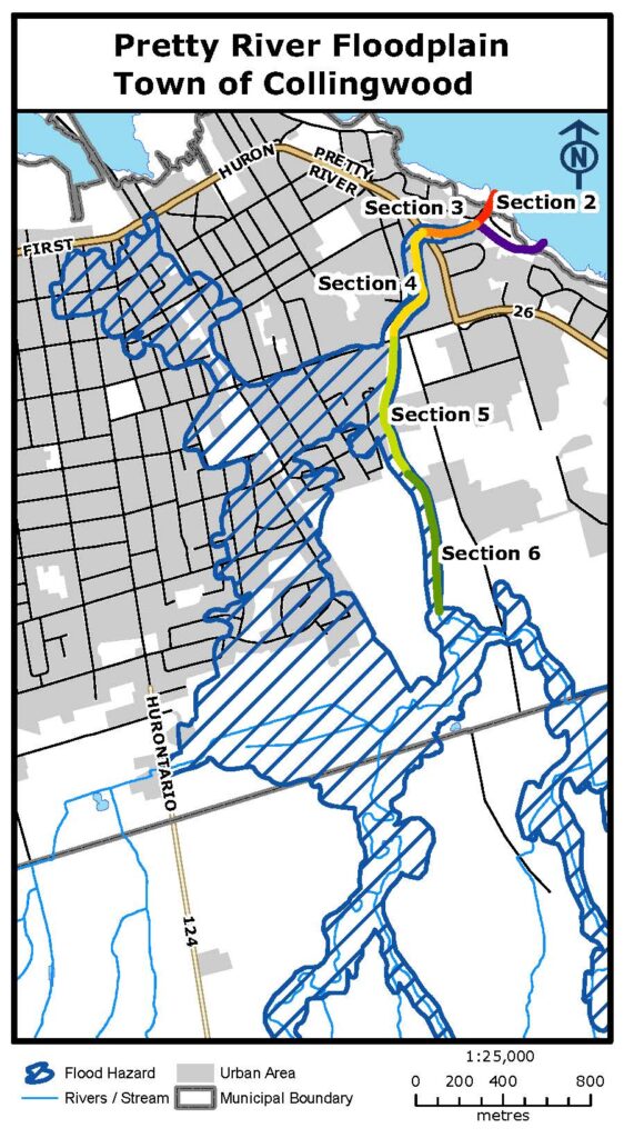
Maintenance work will begin on Sections 4 and 5 (see map in brochure) of the Pretty River Dike. Phase One will start in the Fall of 2021, and Phase Two is expected to start in 2022. To protect nesting migratory birds, vegetation removal will not take place between April through July.
Maintenance work will be ongoing, and residents should expect regular vegetation removal along the dike.
What will the dike look like after the vegetation is removed?
Currently, dense tree, shrub and ground cover are covering the small stone which protects the banks from the erosive forces of flowing water. After the trees and large shrubs are removed, the stone and river will be more visible, when looking from the River Trail.
Fish and Wildlife habitat
It is important to strike a balance for community safety, water quality and habitat protection. Although trees and large shrubs must be removed to ensure flood waters can flow through the dike, groundcover such as grasses and wildflowers along the dike will not be removed. These plants are important habitats for pollinators, including Monarch butterflies, a species of concern. Groundcover is also a great foraging source for many birds.
Low shrubs such as dogwood and willows along the edge of the water will not be removed to continue to support fish and wildlife habitat. Ground cover and low shrubs retained along the dike system will quickly recover from any disturbance associated with removal work. The urban natural corridor associated with the Pretty River will continue to function.
For more information, please contact

 Planning & Permits
 Flood Forecasting